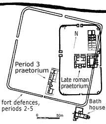
| The writing tablets have been excavated
from levels associated with the pre-Hadrianic, timber forts at Vindolanda.
It is difficult to reconstruct the plans of these because the remains
of the later Roman stone forts and the vicus lie over them. The
figure shows the excavated buildings and a possible outline of the
period 3 fort, although only the line of the southern and western
fortifications has been established with confidence. When we compare
this fort with the later stone fort at Vindolanda and with Roman
forts elsewhere, the position of the praetorium seems unusual.
We might expect it to lie in the central strip, east-west across
the fort, to one side of the headquarters building, rather than
on the road to the south gate.
Click on the image for a larger version. |
Image
details:
The period 3 fort (outline), in relation to the overlying stone built fort. The figure shows the known positions of two buildings occupied in period 3, the praetorium within the fort and the bath house, outside its south-east corner.
Image ownership:
Vindolanda Trust, with modifications |
Nevertheless we can use the better known plans of other forts to
suggest a possible layout of Vindolanda’s pre-Hadrianic forts,
since by the later first century AD the auxiliary fort had evolved
into a standardised form, repeated across the empire.
Two major excavation campaigns at Wallsend in Newcastle have produced
the most comprehensive plan of any fort on Hadrian's Wall. Almost
all of the interior as well as parts of the defences were excavated
and have been put on display. The fort was built in timber in the
Hadrianic period and was rebuilt in stone on almost the same plan
by the mid second century. It lies at the eastern end of Hadrian's
Wall, which slopes from the south-east corner of the fort down to
the Tyne. The site gives a good idea of the typical fort layout,
although the timber forts at Vindolanda were occupied by a larger
unit than at Wallsend. The ten barrack blocks at Wallsend perhaps
accommodated six centuries of infantry and four turmae of cavalry,
probably a cohors quingenaria equitata, a part mounted
auxiliary unit.
Click on the plan or on underlined terms in the map below for individual
buildings ground plans, photos of contemporary state if available
and reconstructions, or follow these links:
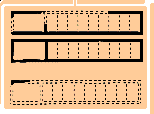
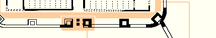
Image details:
A plan of the mid second century stone built fort
at Wallsend, Tyne and Wear.
Image ownership:
© Tyne and Wear Museums (with modifications)
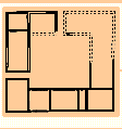
The typical fort has a playing card shape, a rectangle with a ratio
of 3:2 length to breadth, with rounded corners. The forts were often
initially defended with a turf and timber rampart. On sites occupied
for longer periods the defences were rebuilt in stone, especially
from the end of the first century AD onwards. In front was a ditch
or ditches and between the rampart and ditch a flat area or 'berm'
protected against the rampart's slumping into the ditch. Roads into
the fort crossed ditches over causeways or bridges. There was often
one gate in each side, one to the rear (porta decumana) and
one at the front (porta praetoria).
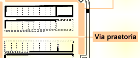
Entering through the 'front' gate, the porta praetoria (the
northern gate at Wallsend), the first buildings met in the front
part of the fort, or praetentura, were barracks, stores and
workshops on either side of the main road (via praetoria).
This road led to the entrance to the head quarters (principia),
in the middle of the central range of buildings (latera praetorii).
Running in front of these buildings was the other main road of the
fort, the via principalis. This central range included the
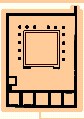
house of the fort prefect and his family (praetorium) and
a single or more often a pair of granaries (horreum / horrea).
The central range also often accommodated another building, such
as a workshop (fabrica) or hospital (valetudinarium).
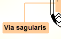
In the 'back half' of the fort (retentura) were four further
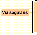
barrack blocks. The fort was criss-crossed by roads between the
buildings and a road that ran immediately behind the rampart (via
sagularis). Other buildings, frequently the bathhouse, lay outside
the fort, and annexes were also sometimes attached which provided
further accommodation for men or animals.
Despite the general similarities, no two forts are identical. Forts
had to adapt to local terrain and had to accommodate units of different
sizes, composed of different proportions of infantry and cavalry.
The 'paper strength' of units is quite likely to have differed from
their actual strength at any one time, and different parts of different
units may have been brigaded together, generating a further variety
of plans. The same suite of buildings was also not provided at all
forts. Numbers and types of workshops varied, for example, and only
some forts had hospitals.
|