Click on the image for a larger version.
|
Image
details:
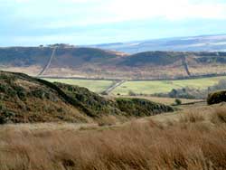
The view from Steel Rigg, onHadrian's Wall,
to Barcombe Hill above Vindolanda. The fort lies just right
of the picture, adjacent to the wood below the hill. In the
far distance the Pennines continue.
Image ownership:
© Vindolanda Trust |

Click on the image for a larger version.
|
Image
details:
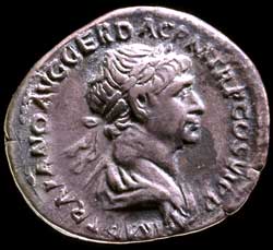
The obverse of a silver coin (denarius) of
the emperor Trajan, with the emperor's bust. AD 112-14.
Image ownership:
Copyright Ashmolean Museum, University of Oxford |
Vindolanda was first garrisoned in the earliest phase of the establishment
of Roman Britain's northern frontier, in the decades immediately
preceding the building of Hadrian's Wall. It was one node in a network
of garrisons and roads across northern Britain. In the first 40
years of its existence the fort seems to have been undergone five
phases of building and rebuilding in timber, before the establishment
of the first stone phase of the fort by the mid-second century AD.
Since only a small area has been excavated, reconstruction of the
layout of Vindolanda and the plans of individual buildings depends
on analogy with forts from which more complete ground plans have
been recovered. Comparison to other forts allows us to estimate
the size and layout of the Vindolanda base. This provides information
on the possible size of the fort garrison, which can be combined
with the evidence of the tablets. From the tablets we can identify
the main garrison units, as well as detachments from other units
stationed at Vindolanda. Occasionally other documents contribute
to reconstructing the history of the garrison, for example tombstones
or diplomas, the documents issued to soldiers on discharge from
the army.
This section of the exhibition describes the background to the
establishment of a fort at Vindolanda and its situation relative
to the forts and roads built by the Roman army in northern Britain.
It then briefly describes each of the five periods of timber building
from which the tablets derive. The archaeologists can assign fairly
precise dates to these periods, from the presence of certain artefacts,
such as coins or from dendrochronological (tree-ring) dates from
the building timbers that survived, as well as from information
in the tablets. Where a layer or period is undated the dates of
earlier and later phases provide some information. The dates given
here follow those given by the archaeologists, but these are likely
to be revised as new information becomes available. The description
of buildings in each period concentrates on the area of the early
forts excavated between the 1970s and the early 1990s.
Continuing excavations inside Stone Fort II and beneath the vicus
to the west are revealing more of these timber phases.
|