Click on the image for a larger version.
|
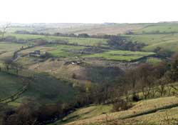
Image
details:
View of Vindolanda, looking north-west from
Barcombe Hill.
Image ownership:
© CSAD |
Records of vegetation preserved in ancient pollen sequences, plough
marks beneath Hadrian's Wall and the existence of many settlements
show that much of the frontier area was being farmed before the
arrival of the Romans. Pollen from Vindolanda itself suggests that
its surroundings included wet meadow, areas used for pasture and
heathland. Tree cover was limited, with alder predominating. There
is no currently no sign of pre-Roman occupation, although any evidence
will lie deeply stratified below the stone fort. The name 'Vindolanda'
might mean 'white' or 'shining' enclosure, in a Celtic language.
The place could have been so named by the local population or by
the garrison, partly recruited from a Celtic speaking area.
The site lies on a plateau, open to the west but bounded on the
remaining three sides by steep banks falling to burns that flow
south towards the Tyne. Thus defended, and with an abundant water
supply, it was suitable for establishing a fort. Vindolanda also
lay c. 17 miles, or a day's march, from Corbridge along the Stanegate,
a suitable stopping off point for soldiers on the move. The first
timber fort only occupied perhaps half the site, but the subsequent
timber forts extended across the whole of the area now covered by
the stone fort and vicus. The principal late 20th century excavations
of the timber forts, have identified the western ditch of the very
first fort and parts of the central buildings and defences of the
later timber forts. Further excavation is required
to confirm the layout and extent of the site in this period, which
continues to offer surprises. In 2000 and 2001 two new buildings
were identified that date to this phase, a bathhouse
south of the fort and a temple to
the west, both on display.
The environs of the fort are likely to be equally rich in archaeology,
so far little explored. North of the Stanegate road geophysical
survey has revealed the existence of many structures, perhaps tombs,
civilian settlement and further military structures, perhaps construction
camps, annexes, or even a fort earlier than those documented on
the main site, contemporary with Agricola's advance into northern
England and Scotland. The tablets show that the fort's environs
may have provided clay, timber and stone (155,
156): stone from quarries on Barcombe
Hill was certainly exploited for building.
|